Mountainwatch | The Grasshopper
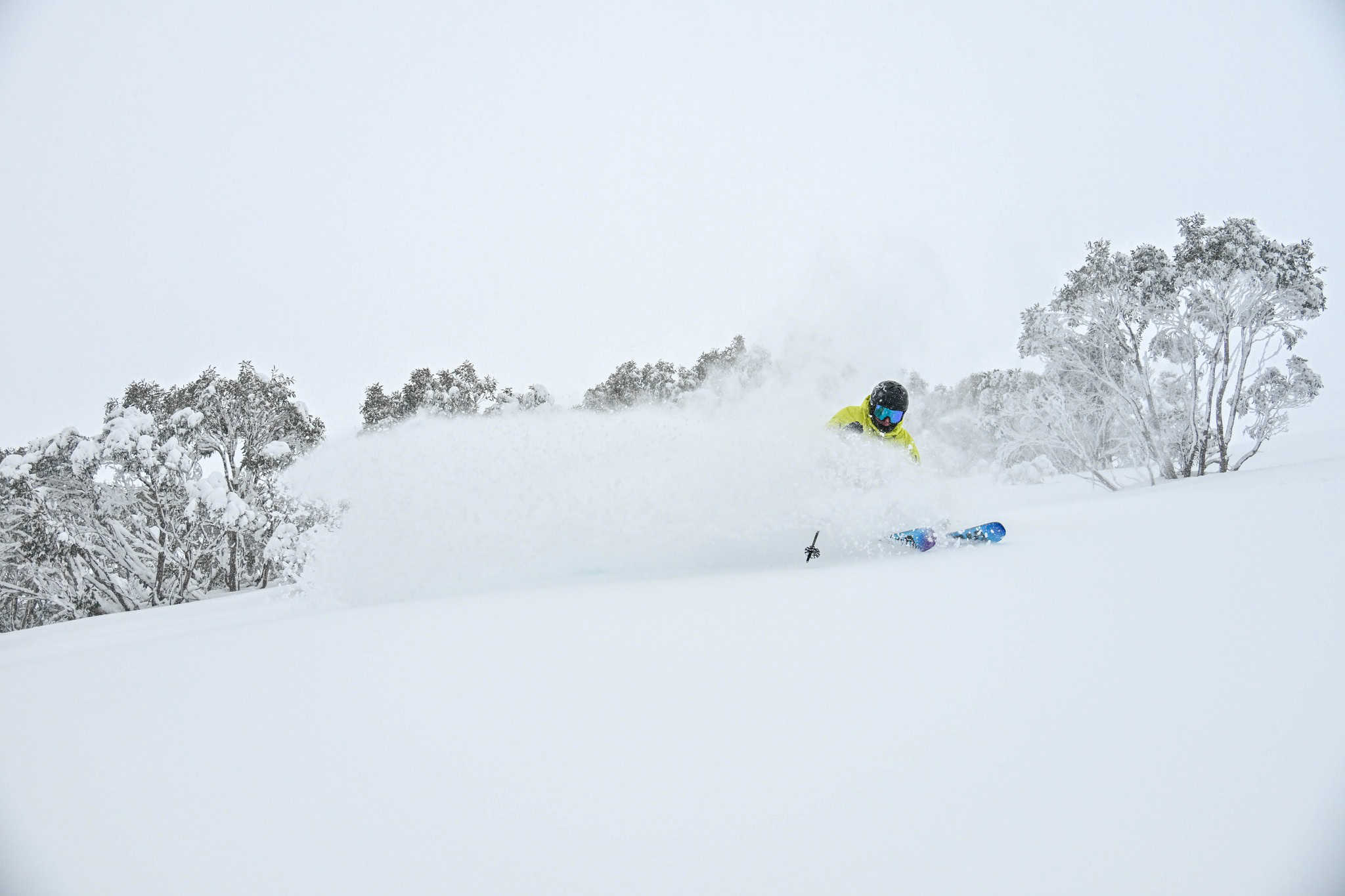
The short-term forecast is looking very healthy with a front due on Friday 19 – Saturday 20 July likely bringing 20-30+ cm to most areas and I’ll have a detailed rundown in tomorrow’s Australian forecast. But what about later in the month?
Looking forward over the next couple of weeks to round out July, medium range models are suggesting frontal systems sweeping across the Great Australian Bight and southeast Australia will become more common. Ski resorts at higher elevations will do well, although base elevations could have some rain in the mix. The details will continue to evolve so stay up to date with the latest forecasts as they become available.
What can we say about the forecasts for August? A rare phenomenon is possibly starting to evolve in the upper atmosphere in the southern hemisphere that could have big impacts. It’s time to talk about Sudden Stratospheric Warming (SSW).
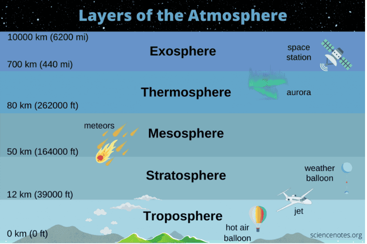
First, some background: the troposphere is the layer of the atmosphere closest to the Earth’s surface, and its where weather systems occur. The stratosphere is a section of the atmosphere directly above the troposphere, about 10-50km above Earth’s surface, and it’s also where the ozone layer is located.

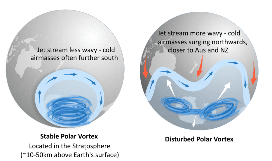
During the southern hemisphere winter an area of increased westerly winds develops in the stratosphere above the south pole, called the polar vortex. It encircles very cold air in the stratosphere. Sudden Stratospheric Warming sees a warming of these cold temperatures and is a process signalling the weakening or disruption of the polar vortex.
I can hear you asking: “But why do we care? The polar vortex is many kilometres above the Earth’s surface! What does this have to do with us?” Let me explain. A weakened/disrupted polar vortex can affect the weather systems closer to the Earth’s surface by changing the jet stream and making it more “wavy.” When the jet stream is wavy it can allow for cold air and frontal systems near Antarctica to move further north towards Australia – and I’m not talking about cold air high up in the stratosphere, I’m talking about cold air near the Earth’s surface. This can result in increased wind and snow for the Australian ski fields. If this is sounding very similar to when the Southern Annular Mode (SAM) is in a negative phase – then you have a good memory. We discussed the SAM in last month’s seasonal update. Indeed, SSW and a wavy jet stream is correlated to negative SAM.

When the polar vortex becomes weakened, displaced from its position over the pole or disturbed (as in the right side image where the vortex has split in two), the jet stream can become more wavy. This then allows cold polar air (in the troposphere) to extend towards the mid-latitudes, including Australia (and warmer air to move towards the pole).
Source: MetService – The Meteorological Service]
We hear about the polar vortex in the context of northern hemisphere more often because it is more easily disturbed. In the northern hemisphere SSW event occur roughly every 2 years; SSW events are rare in the southern hemisphere, with only 3 having ever been observed (in 2002, 2010 and 2019).
Note that an SSW event doesn’t guarantee that the polar vortex will become significantly disrupted to the point where it will impact on Australian weather regimes. At this stage, the current SSW event in the southern hemisphere looks to be contained to the stratosphere and hasn’t penetrated lower down in the troposphere or towards the Earth’s surface. But it could in the next couple of weeksand if it does we could be up for more windy and snowy weather, so stay up to date with my forecasts each Monday, Wednesday and Friday to see how this plays out.


