Guided by a unique 100-year-old map meticulously stitched from seven pieces, two dozen participants embarked on a walk-trip through time, winding through alleys saturated with the city’s 433-year-old legacy.
Published Date – 30 October 2024, 06:04 PM

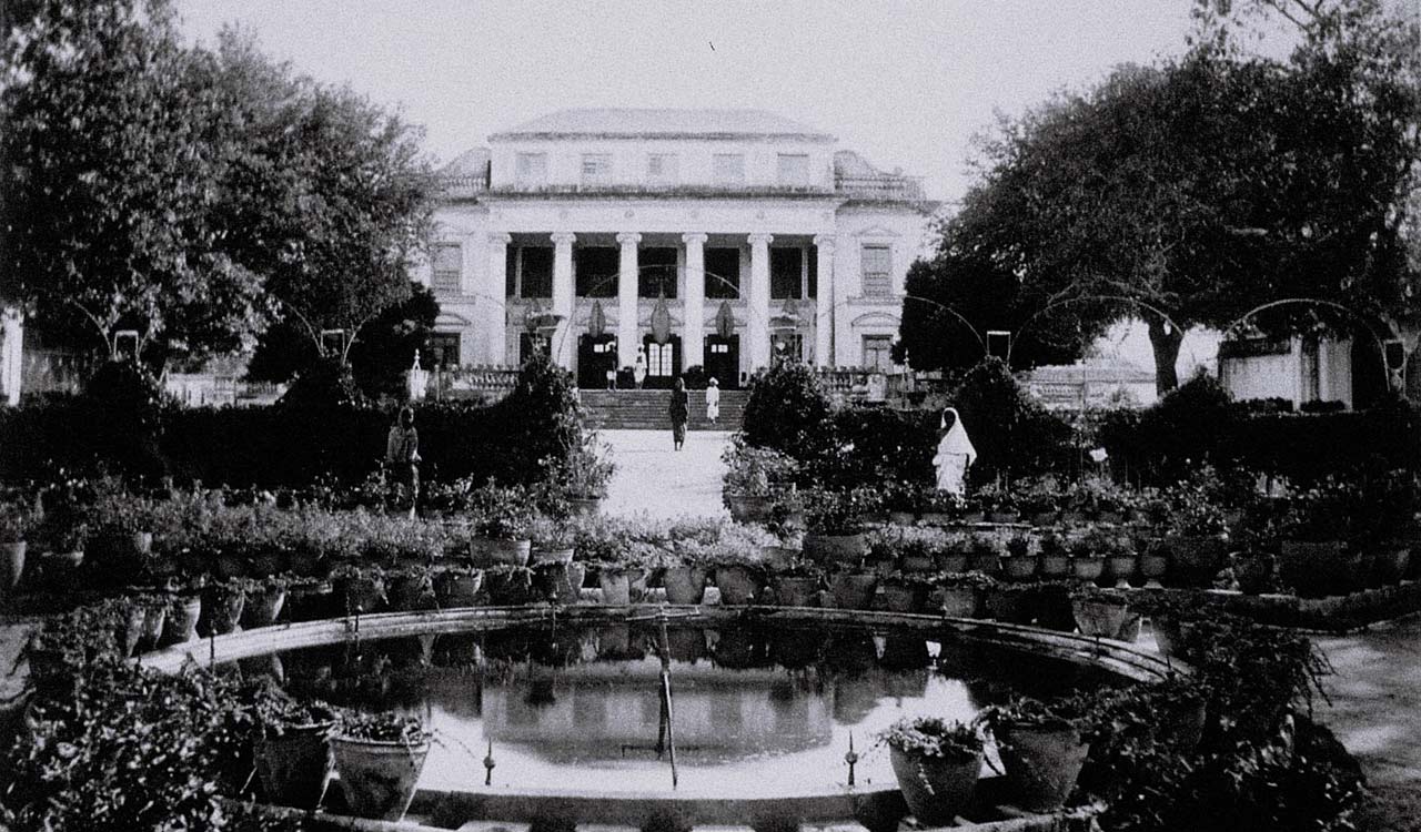
Jahan Numa Palace, as photographed about 100 years ago by Raja Deen Dayal, is now lost to history, as it was foolishly demolished. (Photo Copyright N.Shiva Kumar)
Imagine the pulse of history guiding your every step—a rare invitation to journey into Hyderabad’s heart, led only by the faded etchings of a century-old map. This was the allure of a recent map-walk organized by Deccan Archives and INTACH Hyderabad at Jahan Numa, a historic enclave in Hyderabad’s Old City.
Guided by a unique 100-year-old map meticulously stitched from seven pieces, two dozen participants embarked on a walk-trip through time, winding through alleys saturated with the city’s 433-year-old legacy.
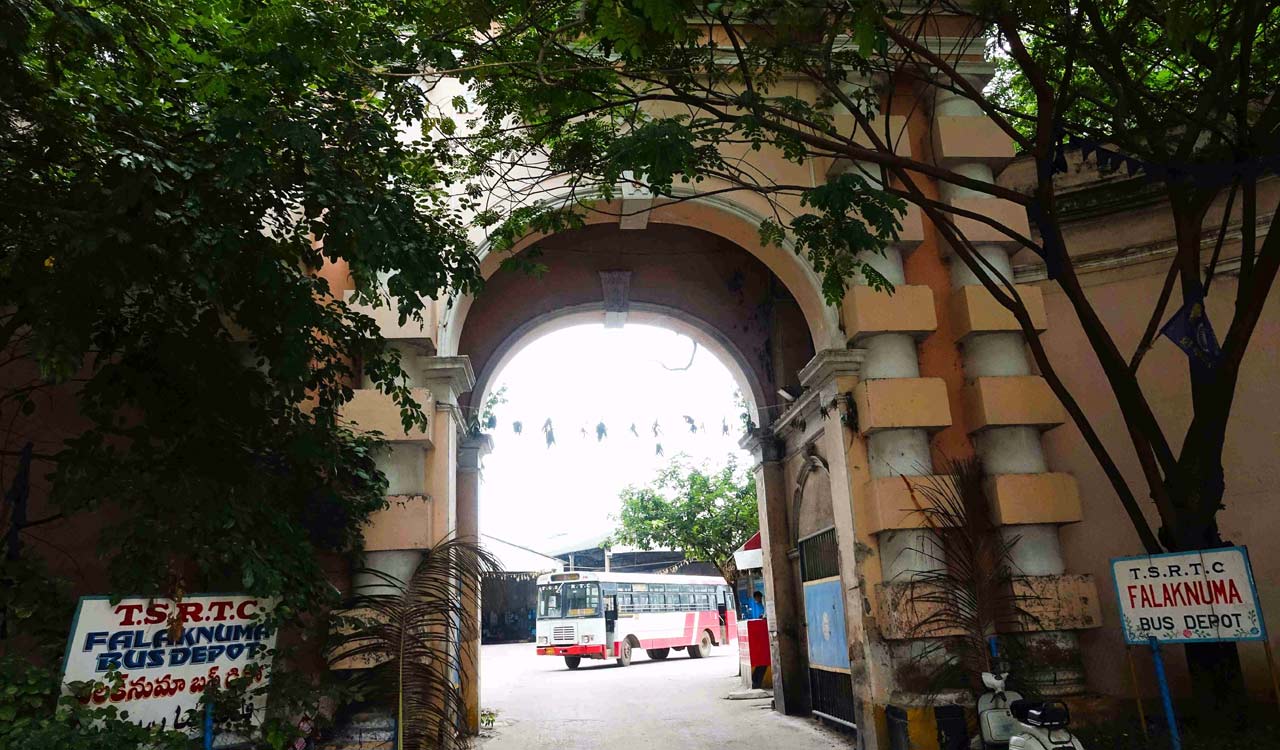
The walk-adventure began at the arched gate of today’s Falaknuma Bus Depot, a structure that, though now modest, once stood as a sentinel to the lush gardens of Jahan Numa. In days past, this spot was a serene oasis amid the city, where towering trees and manicured pathways welcomed visitors to an opulent world.
Today, only the grand gate remains, a silent, enduring testament to the era’s vanished splendour, while the palace that once graced this landscape has all but disappeared, preserved only in sepia-hued photographs by Raja Deen Dayal, the Nizam’s esteemed court photographer.
As the walk continued, participants began to see Jahan Numa through a lens of nostalgia—a patchwork of gardens, grand residences, and military prestige. The Nizams, Hyderabad’s storied dynasty, had endowed this land with palatial estates and fortifications, creating a landscape as rich in history as it was in beauty.
Among these, the Jahan Numa Lancers—an elite Paigahs cavalry unit—had their post here, marked by massive gates, stables, and guardhouses, reminders of a time when the streets echoed with the rhythms of noble patrols. Though today Jahan Numa’s grandeur is largely obscured, its name persists, inviting the curious to glimpse the legacy it holds.
This map-walk aimed to revive Hyderabad’s forgotten history, guiding participants through streets filled with stories of lost heritage. The maps used in the walk were crafted during the elaborate Hyderabad Municipal Survey (1912-1915), initiated after the devastating Musi River flood of 1908. Under the guidance of Sir M. Visvesvaraya, often hailed as the Father of Indian Engineering, the Nizam’s administration launched this map survey to redesign Hyderabad. River Musi was thus fortified and grand building came up on either side.
Participants discovered intriguing landmarks preserved on the map: Tope Khana (an artillery shelter), Dewal (a lone temple), the unique architecture of a Regimental School, an ancient church rebuilt with a high dome, the obelisk-shaped tomb of Captain Johan, Madan Khan Masjid, and the Tikri Biryani Shah nestled amid age-old rocks.
These sites marked and numbered on a poster-sized map, invited walkers to glimpse the delicate weave of history still alive in Hyderabad’s Old City. Through this journey, the city’s lost heritage unfolded, a quiet reminder of Hyderabad’s past resilience, beauty, and enduring allure.

Entrance gate to the Falaknuma Bus Depot, thoughtlessly replaced the once grand gardens of Jahan Numa.
– N. Shiva Kumar


