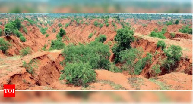
Visakhapatnam: A recent nationwide study has revealed ‘very high’ gully erosion in the Krishna and Kurnool districts of Andhra Pradesh. While erosion is moderate in Visakhapatnam, West Godavari, and Prakasam districts, it is relatively low in Vizianagaram and East Godavari districts. The total affected area is estimated to be around 5-6 square kilometers in Andhra Pradesh.
The study found that 77 districts across India are experiencing high gully erosion. In 2019, India hosted the 14th session of the Conference of Parties to the United Nations Convention to Combat Desertification, where the country committed to halting land degradation and restoring 26 million hectares of degraded land by 2030. To meet this target, the govt must actively address gully erosion in affected districts, as it poses a significant threat to soil stability and land productivity.
Gully erosion occurs when concentrated surface or subsurface runoff, sometimes combined with shallow mass movements, cuts deeply into the soil, forming erosional channels. This process leads to various socio-environmental and geomorphological consequences, including impaired soil quality, depletion of landscape carbon and heavy metal storage, reduced crop yields, deteriorating water quality, and diminished reservoir storage capacity.
Gully erosion also enhances landscape connectivity, alters catchment hydrological functioning, and contributes to significant land-use changes. Moreover, gullies interact with other erosion processes and landslides, driving long-term landscape evolution and facilitating the formation of badlands and other large erosional features. As climate change intensifies, gullies are becoming increasingly hazardous, directly threatening human lives, livelihoods, and societies.
These findings come from a study conducted by researchers from India and the University of Manchester, UK. The team, including Anindya Majhi, Pritha Bhattacharjee, Angela Harris, Martin Evans, and Emma Shuttleworth, published their work titled “gully erosion is a serious obstacle in India’s land degradation neutrality mission” in scientific reports, a nature publication.
According to their results, states covering 38% of India’s territory, including Rajasthan, Uttar Pradesh, Madhya Pradesh, Jharkhand, Gujarat, and Chhattisgarh, account for 92% of the country’s total gullied area.
In India, badlands, which are deeply dissected landscapes formed by prolonged gully erosion, represent the majority of gullied areas.
These badlands are associated with poor regional and socio-economic conditions, including reduced agricultural productivity, water scarcity, frequent droughts, and the abandonment of entire villages.
Early gully mapping efforts in India focused on identifying and reclaiming badlands due to their national policy significance. More recent studies aim to improve the identification and monitoring of badlands using satellite imagery and other technologies. However, despite their known prevalence in central and western India, there is still no reliable, up-to-date data on the spatial extent or severity of gully erosion beyond these areas.


