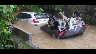
Hyderabad: In response to the devastating 2020 floods which claimed 33 lives, severely impacted over one lakh families, and caused infrastructure damage worth Rs 6,000 crore, the Greater Hyderabad Municipal Corporation (GHMC) has decided to launch a comprehensive stormwater master plan encompassing Hyderabad and Telangana Core Urban Region (TCUR).
The new plan aims to improve stormwater runoff management by putting in place sustainable solutions such as bioswales and rain gardens. It also proposes the use of advanced 2D and 3D sensors to develop a geo-referenced database, along with hydraulic and hydrologic modelling and network analysis.
Given that TCUR’s hydrological balance and ecosystem health depend heavily on major water bodies like Hussain Sagar and Osman Sagar—whose catchment areas stretch beyond GHMC limits—the civic body emphasised the need for a region-wide survey. The goal is to establish an efficient, long-term drainage system that can reduce the impact of urban flooding.
GHMC pointed out that past studies conducted by engineering firms are not geo-referenced and cannot be upgraded in real-time. This limitation hinders the effective management and planning of the stormwater drainage system.
GHMC noted that the present drainage system comprises natural and man-made drains and water bodies that predominantly discharge surface runoff into the Musi and Hussain Sagar. “It is evident from the 2020 floods that the existing drainage system is not equipped to convey the full quantity of stormwater runoff and needs a practical and innovative solution to overcome the problem,” said a senior official in GHMC.
“In today’s digital age, it is important to move away from paperwork and manual data entry and switch to easy-to-use maps and applications that will reduce the time and cost associated with inspections and allow for the visualization and analysis of data. Integrating a validated runoff model with ArcGIS will significantly improve data collection and decision-making—crucial for an effective stormwater management programme,” another official said.
MSID:: 120698715 413 |


