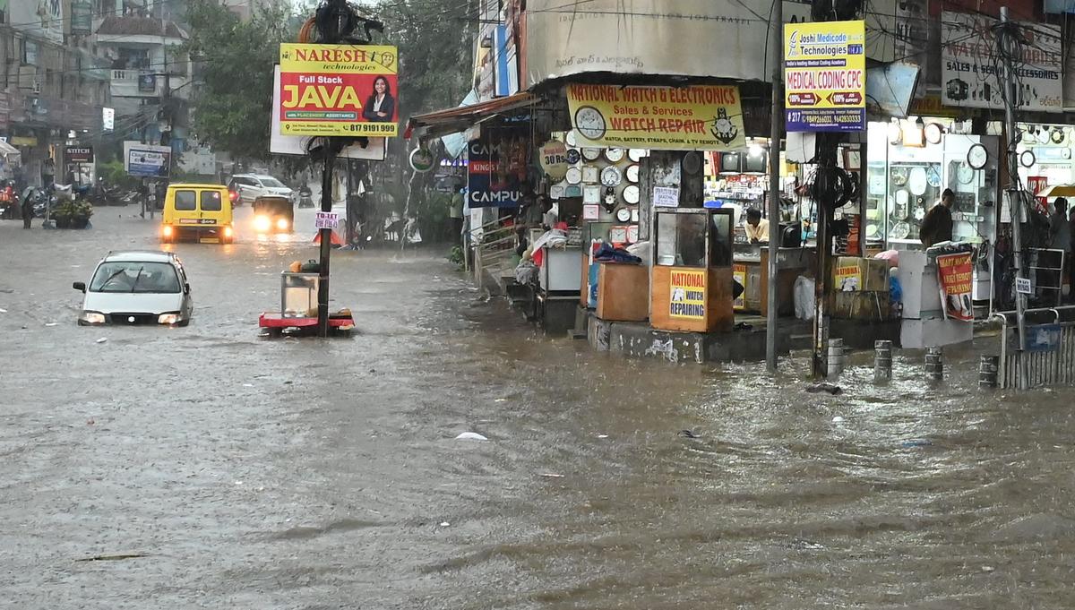
A flooded road in Ameerpet following heavy rain on Monday.
| Photo Credit: SPECIAL ARRANGEMENT
Hyderabad’s lakes may have disappeared over the last century of urbanisation, but the natural valleys remain. And on Monday evening, the valleys reclaimed their path. In a span of two hours, with nearly 10 centimetres of rain lashing central parts of the city — Jubilee Hills (12.4 cm), Yousufguda (11.7 cm), Srinagar Colony (10.6 cm) and Khairatabad (9.9 cm) — stormwater rose through the old drainage routes.
Areas such as Punjagutta (534 metres above mean sea level) and Ameerpet (537 metres above mean sea level) were waterlogged, bearing the full force of nature’s pushback against encroached terrain.
“From Ameerpet Sri Chaitanya to Khairatabad, it usually takes me about 25 minutes on the main road. Due to the flooding, I travelled through Road no.5 Jubilee Hills, KBR Park and now I am stuck ,” said Srinivas Naidu, an autorickshaw driver who ferries schoolchildren, stranded on Road no.14 Banjara Hills around 7.45 p.m on Monday. “It may take another hour to drop them,” he said about the two children in the autorickshaw caught in a traffic jam.
“The spot where Maitrivanam stands today was once an irrigation field with a small water body and a well. There were other lakes and water bodies that drained towards Panjagutta. There was a lake in Somajiguda too. Today, all that remains is the Katta Maisamma Temple outside Yashoda Hospitals,” said Anuradha Reddy of Indian National Trust for Art and Cultural Heritage.
“Wherever you see a Katta Maisamma temple, there was once a lake. And it is these areas that are now getting flooded. At Jalagam Vengal Rao Park too, there is a temple outside. Two streams once flowed from the post office into the lake and downwards to Punjagutta via Sai Baba Temple road. Today, all of that has been built over. The GHMC has even filled up the lake,” she added.
Incidentally, despite the 12 centimetres of rain in the area, the Enugulu Kunta lake or the JVR Park lake remained unfilled on Tuesday morning. Large mounds of lake sediment heaped up in the middle of the lake raised a stink.
In Yousufguda, one lake that existed in the ‘60s has been turned into Krishna Kanth Park, another into Yousufguda Police Ground and yet another lake into National Institute of Micro, Small and Medium Industries. The water that these lakes might have retained, if their carrying capacity was not destroyed, flooded Ameerpet and Panjagutta on Monday.

A water tanker plunges after a section of the concrete cover over a drainage channel gave way at Banjara Hills, Hyderabad, on Tuesday, following heavy rain.
| Photo Credit:
NAGARA GOPAL
A 1985 satellite image of Ameerpet shows four interconnected lakes that once drained into the Hussainsagar. Today, those water bodies lie buried beneath concrete landmarks — Aditya Trade Centre, Ameerpet Metro Station, a playground on Dharam Karam Road, and, most ironically, Swarna Jayanti Complex, which houses the offices of the Hyderabad Metropolitan Development Authority (HMDA). That a town planning body is built atop a lake underscores Hyderabad’s urban paradox. The HMDA complex still holds a faint memory of the past in the form of the Bangaru Maisamma Temple within its premises.
Published – August 06, 2025 12:27 am IST